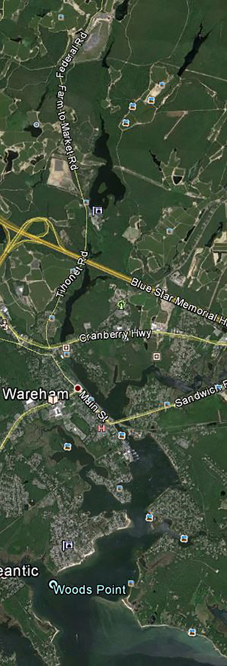
This was last done many years ago but the maps show similar situations for access.
1 You can't cut through Camp Cachalot usually but you might find a way to go to the intersection of Grassy Pond Road and Agawam Rd and find a place to park and put in the pond there, or...
2 In East Wareham go on Route 25 to a north bound Glen Charlie Road travel north on that road to a left turn onto Agawam road, it is a dirt road. Travel quite a way on that road passing the water and a fire break with electric lines - continue north to an intersection that has a right turn that will quickly lead you to the bottom of Besse Bog Reservoir, or...
Use a good map. We parked there in the past.
This is a dirt road and it may be rough so use an appropriate vehicle.
3 You can also get there easier from Glen Charlie road as it passes to the east of Glen Charlie pond - to north on Plymouth Avenue to a left onto Churbuck st - 1st right onto Mayflower Lane - head north until a left onto Festive Lane then a right onto (Leisure Lane) head north until the road that goes west to the bottom of Besse Bog Reservoir. Use a good waterproof map for all of these directions.
______________________________________________________________
Start at the south point (unless you can get into the north point) of Besse Bog Reservoir (we called it Stumpy Pond).
at the bend in the small stream we camped on a peninsula that rose from the body of water where the pond became a creek. I have no idea who owns the land so beware. This is our regular trip back and forth over Besse Bog Reservoir. I don't know why but we liked it. You can then turn around and go south to the point of entry and go over the dam in a portage.
Put the canoes in the water again and continue south through the small stream (it is beautiful) and come into a wider area that becomes Glen Charlie Pond.
Look at a topographical map to understand how to get to the damn.
At the bottom there is a another dam - continue a short distance to the Agawam Road area.
Do not go into the pond that is just over the road.
Portage to the left a bit as long as you are going south and find the small stream - take that.
It gets wider as you go south into Mill Pond.
You get to Route 25 - go under it in the cutaway area and continue over Rt 6 into the small stream until Cranberry highway -
Portage there and continue downstream - you will see the railroad tracks on the left - continue then get to where you will go under or over (I forget) Sandwich road.
Continue South.
Go to a pickup place at the bottom of Shore Avenue (boat ramp, beach and parking lot where you will have a vehicle parked.____ This trip can be changed in a lot of ways - have fun.
Below does not show all of the narrow streams between the larger bodies of water.